
Buckingham Mills: Baber’s Mill
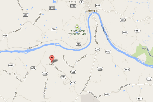
“A” Marks the Mill Pond on Rock Island Road
The 1863 map of Buckingham identifies Baber’s Mill, located on present day Rock Island Rd., sitting at the bend by Hundley’s Branch Rd., not far from Warren Ferry.
A surviving mill pond, at 37.743376,-78.547252, lines up perfectly with the mill site on the 1863 map. Was this the mill run by Robert Lindsay Baber, who lived on Rock Island Creek, and is mentioned in the Buckingham County land tax records? In 1863, Robert was in his mid-thirties, married to Elizabeth Jones, and supporting nine children. Not surprisingly, a Jones farm is identified on the 1863 map, just to the west of Baber’s Mill.
In 1880, Elizabeth M. Baber was the postmistress at Rock Island. In 1905, the mail for that area was transferred to Warren.
Can a Slate River Ramblings reader provide more information about Baber’s Mill and/or the Rock Island post office? If so, please comment.


I’m pretty sure this was the mill site run by Robert Lindsey Baber. In Buckingham County, Va Land Tax Summaries & Implied Deeds Vol 3 – 1841-1870, it specifically mentions:
“bought: 1867 – for as much land of grantor as may be submerged by reason of the said Baber raising the dam of his grist mill and saw mill on Rock Island Creek an additional altitude of 2 feet.”
This was two years after he bought the 360+ acre tract in 1865. Maybe he was improving the mills’ capabilities. Furthermore, I know that one of his sons, Atticus Baber ran the grist mill well into the 20th century. He died in 1947 and it was still operating. I do not know the history after that, other than it was gone years ago. Hurricane Camille, in 1969, was responsible for washing away many of the smaller dams and mill sites in the northern part of the county, so possibly it was then. I will inquire further with Lindsey Tapscott, he grew up on the adjacent property.
Thanks for the details!